Version 3.0 of the FlightView system adds FAA RNAV (GPS) approach plates, airport diagrams, and approach procedures to the FlightView MFD and navigation system. These are currently considered experimental features as there are a few key functions (missed approaches, procedure turns, holds) that are still under development. While this is still “experimental” we’re offering the plates and database for free. When we have the feature ready for prime-time we will be charing a small subscription fee for the data – something in the range of $10 / month or $100 / year.
Here’s how to get it all set up and working…
Configure the FlightView App
- Make sure you have version 3.0 or later installed on your iPad
- Enable the “Instrument Approach Procedures” in the new “Experimental Features” settings page.
Download the Data
- On a computer (not the iPad) download the plates data, which comes as a 3.95 GB zip file.
- Unzip the file which will take another 4.25 GB, so you will need about 8.25 GB free.
- Copy the resulting “charts” directory into the root directory of a USB 2.0 flash drive.
- Connect the flash drive to an available USB port on the Flight Data Computer or hub.
You’ll need a USB flash drive with at least 4.25 GB of available storage. Don’t try to use a USB 3 flash drive as the Flight Data Computer does not support USB 3. Don’t use a USB 1.0 thumb drive as the copy process would take several days. If you don’t have a good USB 2.0 flash drive, order one of these.
Using The Approach Features
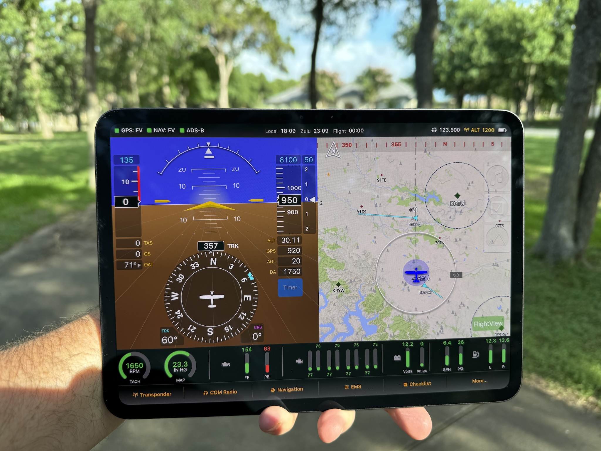
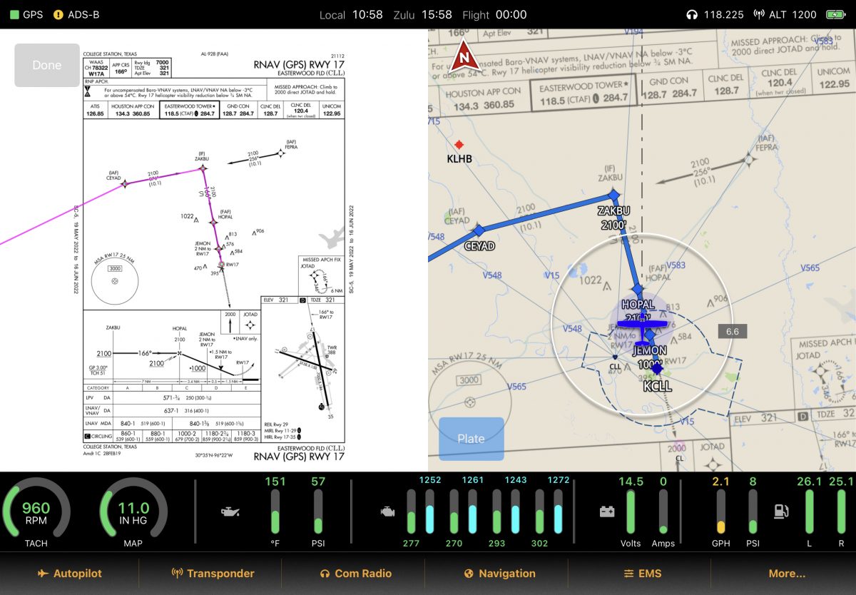
To load an approach, enter a flight plan that ends at an airport with a GPS approach. In the Flight Plan screen, select “Add Procedure”. Select the transition and minimums and tap “Load Approach”. The system will add the approach waypoints to your flight plan and load the plate directly to the MFD. You can toggle to a regular north-up view of the plate by tapping the blue “Plate” button.
Using The Airport Diagram Feature
The system will automatically load the airport diagrams for the origin and destination airports when a flight plan is loaded. The approach diagram will appear automatically on the moving map. Note that generally only tower-controlled airports have official FAA diagrams. Also note that several FAA diagrams are currently missing for larger (Class B and Class C) airports due to geo-referencing difficulties.
The Legal Stuff
The approach features in FlightView do not make it a legal navigation source for use in instrument flight operations. These features are intended only for use as a training aid, as a supplemental source of situational awareness, and as a backup for use in declared emergencies.
Note that the data available from the download link above is not current – it’s from earlier this year. There may have been changes in approaches in the intervening months. When we launch the subscription service we will begin monthly updates of the data. Until then I’ll update the charts.zip file manually on a periodic basis.